Part 3: The Saluda Old Town Treaty
In the summer of 1755, amid the escalating French and Indian War in the northern colonies, South Carolina’s Royal Governor, James Glen, worked urgently to secure Cherokee neutrality or alliance against French influence. The Cherokee, facing pressure from encroaching European settlers and rival tribes, sought reliable supplies of guns, ammunition, and trade goods.
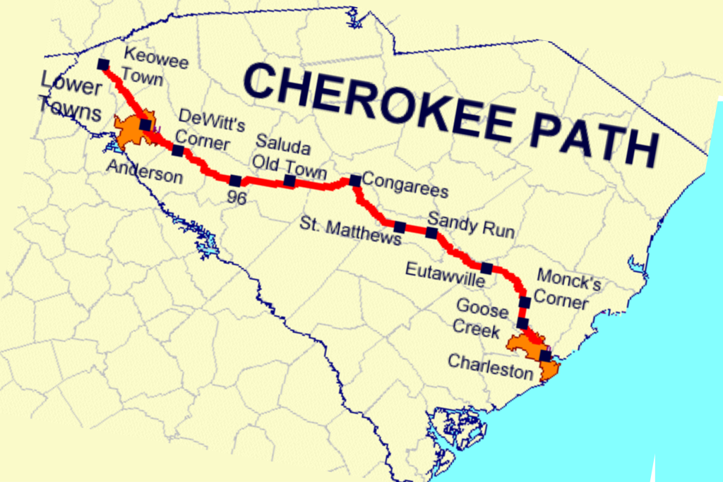
Both sides desired a diplomatic meeting, and they sought a neutral site along the ancient Cherokee Path connecting Charles Town and the principal Cherokee town of Keowee.
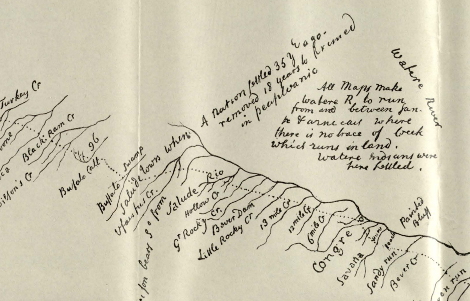
They selected a spot on the Saluda River, known as “Old Town.”
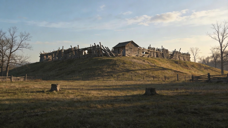
Old Town was an abandoned Native site on the banks of the Saluda River. It featured a low mound and an open plaza, originally constructed around 1,000 years earlier during the Mississippian era. Mississippian peoples typically built flat-topped mounds to support ceremonial structures and important buildings, surrounded by a ring of huts on the plaza’s perimeter. After enduring decades of hardship, the original inhabitants abandoned the village, dispersing north and west.

More than a century later, around 1690, the nomadic Saluda Indians—a Shawnee-related group distinct from the Cherokee or Catawba—occupied the abandoned site. They stayed only until 1712, when unrest in the backcountry and the looming Yamasee War prompted them to migrate northward toward Pennsylvania.
But the Saluda left something behind: their name, which meant “river of corn.”
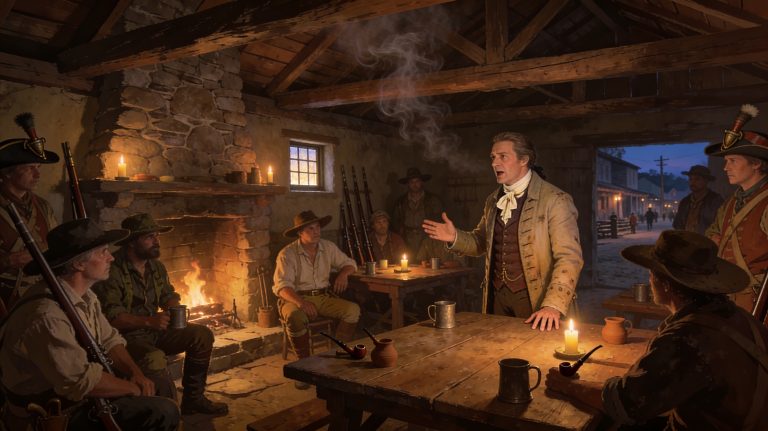
On July 2, 1755—a hot summer day in the southern backcountry—the Cherokee delegation from Keowee met the British delegation from Charles Town at this fading clearing on the riverbank. Though the forest was slowly reclaiming the site, a grass-covered mound, about eight feet high, still stood as a quiet reminder of its ancient past.
It was the future, however, that was on the agenda for that historic meeting.
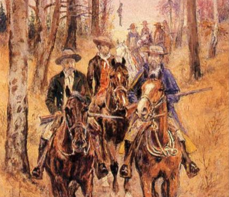
Governor Glen was in the company of a formal colonial entourage, including council members, officers, and a military escort. Leading the Cherokee was Conocotocko, the Peace Chief known as “Old Hop,” accompanied by several hundred warriors and prominent headmen, including the skilled diplomat Attakullakulla.
The participants in this large council addressed longstanding disputes, renewed alliances, and negotiated terms amid growing Anglo-French competition in the interior.
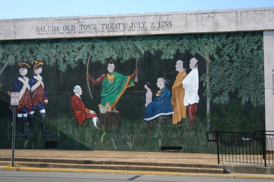
A deal was struck.
The British offered gifts, presents, and solemn promises of peace, protection, and alliance. While no direct monetary payments or additional land transfers were involved, they committed to constructing Fort Prince George near Keowee.
In exchange, the Cherokee ceded control over a vast area totalling at least a quarter of the total area of South Carolina. They explicitly acknowledged the sovereignty of the King of England over this entire territory, including the land that is now ancestral to many Saluda County residents.
The Old Town Treaty carried profound significance for South Carolina’s colonial expansion and the wider geopolitics of North America.
Nationally, it bolstered British dominance in Cherokee territories during the French and Indian War (1754–1763). Coming just days before the British defeat at the Battle of the Monongahela (Braddock’s Defeat), the agreement helped prevent a potential Cherokee-French alliance and stabilized the southern frontier.
For South Carolina, the treaty opened the backcountry to rapid European settlement. Almost immediately, an influx of immigrants began arriving from northern colonies—such as Pennsylvania, Virginia, and North Carolina—as well as from various European countries. The Old Wagon Road and the port at Charles Town bustled with activity.
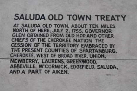
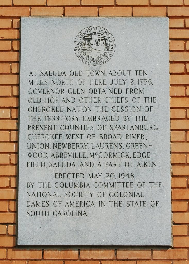
The British now had formal control of the area that would someday be divided into the counties of Spartanburg, Cherokee (west of the Broad River), Union, Newberry, Laurens, Greenwood, Abbeville, McCormick, Edgefield, part of Aiken, and, of course, Saluda.
In the short term, most everyone involved was hopeful. Long term, however, the Treaty followed the familiar colonial pattern of the British – successfully acquiring Native lands, but failing to follow through with all their promises.
Yet, within South Carolina, the treaty stands out for settling the entire Cherokee claim inside the colony in a single, comprehensive agreement. This decisive step cleared the way for the backcountry’s transformation into a region of growing population and economic activity. The settlers who poured in—many Scots-Irish, English, Germans, French, and others—would form communities that, over the coming decades, developed distinct social, economic, and political identities.
The differences among the various communities—between tidewater elites tied to coastal trade and backcountry farmers often frustrated by distant governance—eventually sparked divisions that would emerge in the coming years.
Today, the site is listed on the National Register of Historic Places (added in 1972). Markers, murals, and memorials throughout Saluda County honor its role in shaping the state’s boundaries and historical identity. There is no doubt that the Saluda Old Town Treaty remains the most consequential event ever to occur within the footprint of Saluda County.